Azure Maps
An Azure service that provides geospatial APIs to add maps, spatial analytics, and mobility solutions to apps.
593 questions
This browser is no longer supported.
Upgrade to Microsoft Edge to take advantage of the latest features, security updates, and technical support.
' cx='32' cy='32' r='32' /%3E%3Ctext x='50%25' y='55%25' dominant-baseline='middle' text-anchor='middle' fill='%23FFF' %3ECW%3C/text%3E%3C/svg%3E)
Hi
I've been asked to post this question here after previously posting it on the Power BI Community. So apologies if this isn't the correct place.
When making a selection, I get data points that are outside of the selection I've made. After doing a bit of playing around it seems to be related to the edge of the map, when your selection goes over the edge.
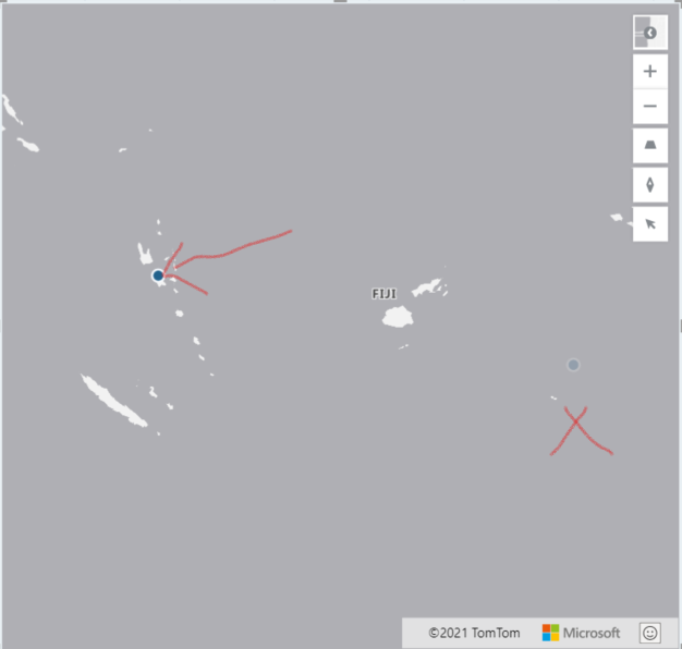
Here's what I mean:
using the circle selection you can see the issue best where the selection is somehow inverted, it looks like there is a similar issue for all selection types:
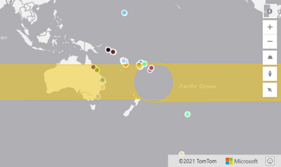
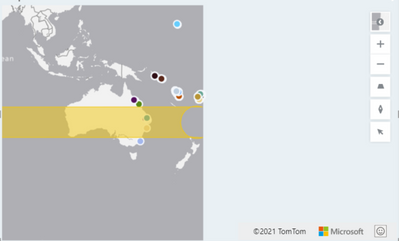
Upon further investigation it might be related to the edge of the world map as shown here:
Hope this makes sense.
(Original Power BI post here: https://community.powerbi.com/t5/Desktop/Azure-Map-Visual-Selection-Control-Bug/m-p/2186362#M801385)

I believe the drawing tools have limited support for the anti-meridian. Doing some testing, it appears to only be the circle that has this issue. I'll reach out internally to the Azure Maps team and let them know as its odd that the polygon drawing is working fine but not circle (circle is just a round polygon).
Thanks for the response, I'm also getting this for the polygon selection too, this might be specific to the Power BI version of Azure Maps perhaps.
Below is the polygon selection I made:
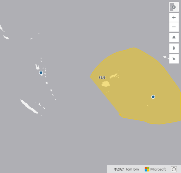
This was the result, it selected points outside of the polygon: