Spatial Heat Map Explorer - A Windows Store App to view Heat Maps of POIs
Sometime back, I came across this brilliant book, Location Intelligence for Windows Store apps by Ricky Brundritt. I thought to go-ahead and extend the implementation of Windows Store app of heat map by Ricky Brundritt, provided as part of the book to convert it into a generally consumable spatial heat map explorer.
I’ve kept Ricky’s implementation intact and exposed options for,
- Import the point of interest (longitude and latitude) as CSV, JSON, XML and Excel file
- Edit (each edit updates map view through INotifyPropertyChanged) imported Longitude and Latitude on a fly within the app
- Export/Save edited values as JSON, CSV or XML
- Save Map as Image (PNG)
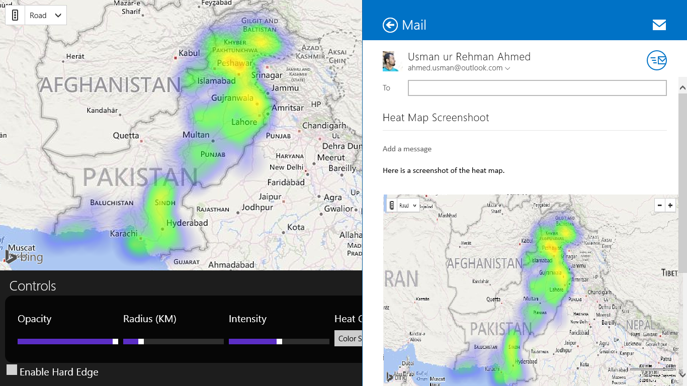
- Share modified Image through Share charm
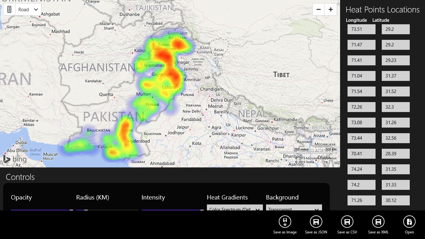
How can this possibly be used? Here’s a sample map detailing Meteorological Observatories in Pakistan by simply importing longitude/latitude pair through an excel file. Folder ‘Sample Data’ as part of the attached solution contains above sample in every supported format. Please note that the code may not be of highest standard and error handling may not be proper as its just a humble attempt to extend something useful already out there.
Please note that Bing Maps aren’t much matured in Pakistan and as an Audience Marketing Manager (AMM), part of the DX group, that’s amongst the top asks from local developers, however anticipating that this will change in days ahead, I hope this little addition will help some fellow developers.